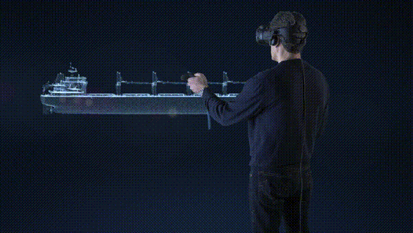
From 2D Blueprint. To Reality. Instantly.

Software

// SHIPREMOTE

Remote Support &
Spatial Intelligence

ShipREMOTE offers MR video call communication capabilities with data provisioning in synchronous mode and remote spatial data (2D and 3D) anchoring and retrieval in ship locations/equipment both static (drawings, photos, videos, animation) and dynamic (PMS status, etc.) with embedded project management (tasks, checklists, notes, etc.) and works both in synchronous and asynchronous modes.

01
Augmented Navigation

Navigate immersively within the ship and teleport to different areas of interest

02
Identify vessel particulars

Identify machinery, and provide machinery-specific information

03
Access to Vessel Data

Access to drawings, P&IDs, PDF manuals for maintenance & troubleshooting

// Our Innovation

Immersive Vessel Visualization & Intelligent Data Access

ShipREMOTE revolutionizes ship operations and maintenance through an immersive 3D BIM environment that merges spatial awareness with contextual intelligence. Users can seamlessly navigate and teleport within the digital twin of the vessel, instantly accessing areas of interest.

// Key features

Spatial Intelligence & Operational Insights

Each piece of machinery is smartly identified, with interactive access to associated drawings, P&IDs, and technical documentation such as operation, maintenance, and troubleshooting manuals. Machinery and systems are contextually highlighted, ensuring clarity and precision in inspection and decision-making. ShipREMOTE further enhances collaboration by enabling users to capture and attach notes, tasks, photos, and videos directly to vessel locations and equipment, ensuring that insights and observations are preserved within their spatial context.

// Be the pioneer

REQUEST A DEMO